Dynamic Runways
Skills
Adobe Flash, including ActionScript and web services

Summary
This application is a front end consumer of the Assured Aviation Web Services (AAWS) project of DSI, in partnership with NASA’s Small Aircraft Transportation System (SATS) program.
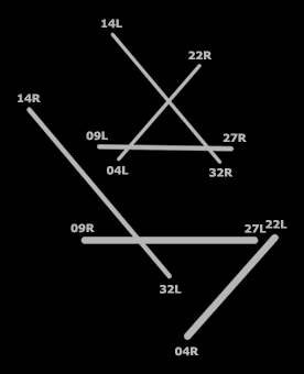
Digital Runways connects to an in-house web service to retrieve latitude/longitude coordinates for the runways of a given airport. After crunching the math, this app remaps those coordinates to an inverted Cartesian system, drawing a visual diagram less cluttered than the airport’s FAA approach plate, shown below.

